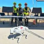

Remote monitoring and control (RMC) is revolutionizing how the solid waste industry collects, processes, and visualizes critical data. With a fleet of FAA-licensed drone pilots nationwide, RMC is at the forefront of developing drone services that enhance operational safety, improve efficiency, and optimize data management processes. By leveraging cutting-edge drone technologies and GIS-based data assessment tools, the waste management industry can streamline remote data collection and decision-making processes.
This presentation, Advancing Drone Technologies for the Solid Waste Industry explores how drone technologies are reshaping industry practices, offering solutions that reduce operational costs, minimize environmental impact, lower health and safety risks, and improve overall site efficiency. Attendees will gain insights into the latest advancements in drone applications and learn practical strategies for integrating these technologies into their operations.
Specifically, attendees can expect to learn:
Meet SCSers, Phil Carrillo, National RMC Director/VP and Melissa Russo, Business Manager – Drones & GIS.

Phil is a systems integrator with over 24 years of experience in the operations and maintenance (O&M) of landfill gas (LFG) extraction and treatment systems. Phil has managed the design and installation of over 180 RMC systems for 100 clients. In addition to serving clients with customized design, installation, and support of SCS RMC solutions, Phil is an FAA Part 107 drone pilot and leads the development of advanced drone technologies and custom software applications that enhance data management and operational efficiencies for the solid waste industry.
Melissa Russo leads SCS RMC’s drone services. She is instrumental in managing the administration and installation of approximately 150 RMC projects and as an FAA-licensed drone pilot, she leads the development of SCS’s drone services, identifying the latest applications to benefit clients in optimizing remote data collection, GIS integration, and data management. Melissa has managed and performed numerous aerial inspections nationwide and internationally for purposes such as thermal surveillance, methane leak detection, topographic mapping, stockpile calculations, aerial 2D imagery, and 3D mapping. She is responsible for integrating GIS with drone-collected data to enhance field data collection and analysis, enabling more precise and actionable insights for clients.
Explore the full list of sessions from SCSer’s at the SWANA Western Regional Symposium, we look forward to seeing you! Register today!